LONGS PEAK AS AN OVERNIGHT
Keyhole route stats from 14ers.com| Difficulty: | Class 3 |
| Exposure: |  |
| Summit Elev.: | 14,255 feet |
| Trailhead Elev.: | 9,400 feet |
| Elevation Gain: | 5,100 feet |
| RT Length: | 14.00 miles |
| Trailhead: Quad. Maps: | Longs Peak Longs Peak |
Last weekend I did Longs Peak as an overnight. Longs peak is such a long hike that it ends up presenting single day hikers with a toss up. Either you start very early, and by early I mean hikers regularly start between one and five o'clock AM, or you risk being kicked off the peak by weather before getting a chance to summit. Now I enjoy hiking by headlamp light as much as the next person, but...
Longs Peak was named for Major Stephen Harriman Long who led a surveying expedition in the Colorado Rockies in 1820. While Arapaho Indians likely summited Longs Peak trapping eagles well before, Major John Wesley Poweell is usually credited with the first ascent in 1868, starting from Grand Lake. It is the highest peak in Rocky Mountain National Park and is also the norhthernmost 14er in the Rocky Mountains.

Because I was starting mid-morning, I had to park a ways down the road from the trailhead. If you are overnighting, make sure that you park your vehicle with both of your wheels completely to the right of the white line. Since the parking lot and the road leading to the trailhead is outside the park, it is actually patrolled by the highway patrol and you can receive a parking citation. There is a first-come-first-serve campsite near the trailhead. There are three backcountry camping sites along the East Longs Peak Trail, one of which is for large groups only. The first site is called the Goblin's Forest, which really isn't very far into the trail, however it is well sheltered in some short pines.


Longs Peak is a very popular destination and if you are looking for solitude on a weekend, this probably isn't the trail for you. The Diamond, an east facing, 2,000 foot tall, sheer granite wall, makes the peak a distinct and inspirational landmark.
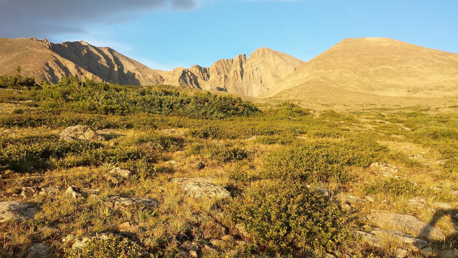

Since I knew I had all day, I took a short detour on the Chasim Lake trail to snap a picture of Peacock Pool and Columbine Falls.


I reached The Boulderfield in about 3.25 hours and setup my tent. These campsites are booked full almost every night of the peak season, so the critters are used to scavenging from the patrons, so they are pretty friendly.

The next morning I was up and heading up the trail just before sunup, around 6:15 AM.
 |
| The view of the Mount Lady Washington ridge-line as I emerged from my tent. |
 |
| Being at the foot of the short, steep hill that leads to The Keyhole just after sunrise, made for a great photo-opp. |
 |
| There is a small shelter just below The Keyhole where hikers can get out of the wind for a brief break before pressing on. |

 |
| Photography Tip: Either before or after you snap a pic, take a picture of your altimeter/clock. This will help you match your photos to a timeline or map of your hike afterwards. |
After emerging from The Keyhole, the magnificent Glacier Gorge spreads out before you, nearly 3,000 feet below. Turning to my left (south), I saw the section known as The Ledges laid out before me, stretching to the area called The Trough. Such epic sounding names for everything, right?! The Ledges are just under a half mile of exposed traversing along the tops of massive rock slabs. There is one short steep section where climbers can assist their assent with some steel reinforcement bars anchored into a large rock.
 |
| Bullseyes or "Fried Eggs" allow hikers to navigate the trail where building a cairn really isn't realistic. |

The Trough, is usually lined with snow up until mid July, so an ice axe may be required prior to that. The passage bottlenecks at the top where several large slabs of rock again provide a challenge. I noticed several climbers cling to the 15 foot, smooth rock directly below the crest of the ridge, but I chose to use the large slabs as a stairway and weave my way back and forth, hand over foot.

When I emerged at the top of The Trough, I found myself in a small crook in the ridge now facing south with a spectacular view. Turning to my left again, (east) the somewhat unnerving sight of The Narrows reveals itself. Everyone says its scarier in pictures than it is in real life and they are right. The Narrows consist of a single ledge with a very steep drop off to the south. The narrowest section is about three feet wide and is located near the beginning of the section, then is slowly begins to widen out.

At the end of this section I scrambled over the last ledge and The Homestretch showed the obvious route to the summit via several cracks running parallel to each other. Stick to the cracks progressing on hands and feet, avoiding the smooth rock faces on either side.

The summit is a very large flat area scattered with large boulders. From The Boulderfield to the summit took me right at two hours and I had plenty of company. I recommend walking around the large summit area to take in the views from all angles and to revel in the sense of accomplishment such a summit offers!


 |
| The Boulderfield from the summit, see my tent right down there?! |


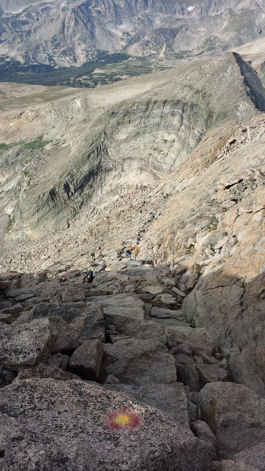 |
| Looking down from the top of The Homestretch |


.jpg)


