THE COLORADO TRAIL
Denver to Breckenridge
Trip Stats
Starting Point: Waterton Canyon Trailhead, Denver, CO
Starting Time: Sunday, July 14th, 7:00 AM
Ending Point: Goldhill Trailhead, Breckenridge, CO
Ending Time: Friday, July 19th, 12:30 PM
Total Distance: 105.1 Miles
Average Distance Per Day: 17.5 Miles
Net Elevation Gain: 3,680 Feet
Sum Elevation Gain: ~15,000 Feet
Average Sum Elevation Gain Per Day: ~2,700 Feet
Time: 126.5 Hours (5.5 days)

The week of July 14th, an Army buddy of mine, Neal Metzler and I backpacked the first six segments of The Colorado Trail, from Denver to Breckenridge. Our original plan was to hike it in seven days but we ended up completing it in five and a half.
 |
| The journey begins |
On day one, Sunday, we had originally planned to hike from the trailhead to a campsite noted in the guidebook from The Colorado Mountain Club at 11.8 miles into Segment One. But after hiking up Waterton Canyon Road in just two hours and making Lenny's Rest through a very muggy, heavily forested area in another hour, we made it to this campsite at 11:30 AM. We decided that this was just too early for our stopping point and there was no water available. We braved the gathering storm clouds and pushed on to a spot about a half mile above the Platte River. It was still early afternoon, but still burdened with seven days worth of food and facing a long stretch without water after crossing the river, we decided to setup camp for the day. We made a run to the river to fill up on water, during which we noticed that there were plenty of camping spots available closer to the river on the east side, but none available on the west side. We were chatting after supper when we noticed that some scary looking clouds began streaming over the mountain we had descended earlier that day, around eight o'clock. We barricaded ourselves inside our tents just in time for the deluge to begin. The next morning, everything was soaked after raining hard off and on the better part of the night.
 |
| Monday morning at the Platte River trailhead |
On Monday, we packed up our wet camp and headed down to the river. There we found a beautiful scene with low clouds still shrouding the peaks. I brushed my teeth and bathed on the river bank with my handkerchief with very cold water. After filling up on water and scrubbing out our extra pair of socks, we crossed the bridge and headed uphill.
 |
| Overlook just above the Platte River |
Segment Two has the longest stretch without water, so we made sure to saddle ourselves with as much as we could carry, 4.5 liters for me and 3 liters for Neal. After climbing up to an old quartz quarry, we entered the Hayman Fire burn scar area. Even after more than a decade, this area is still an ugly reminder of Colorado's largest wildfire. Exposed to the sun most of the time with views of a whole lot of burned and rotting trees, Neal and I both agreed later that this was the roughest part of the trail.
 |
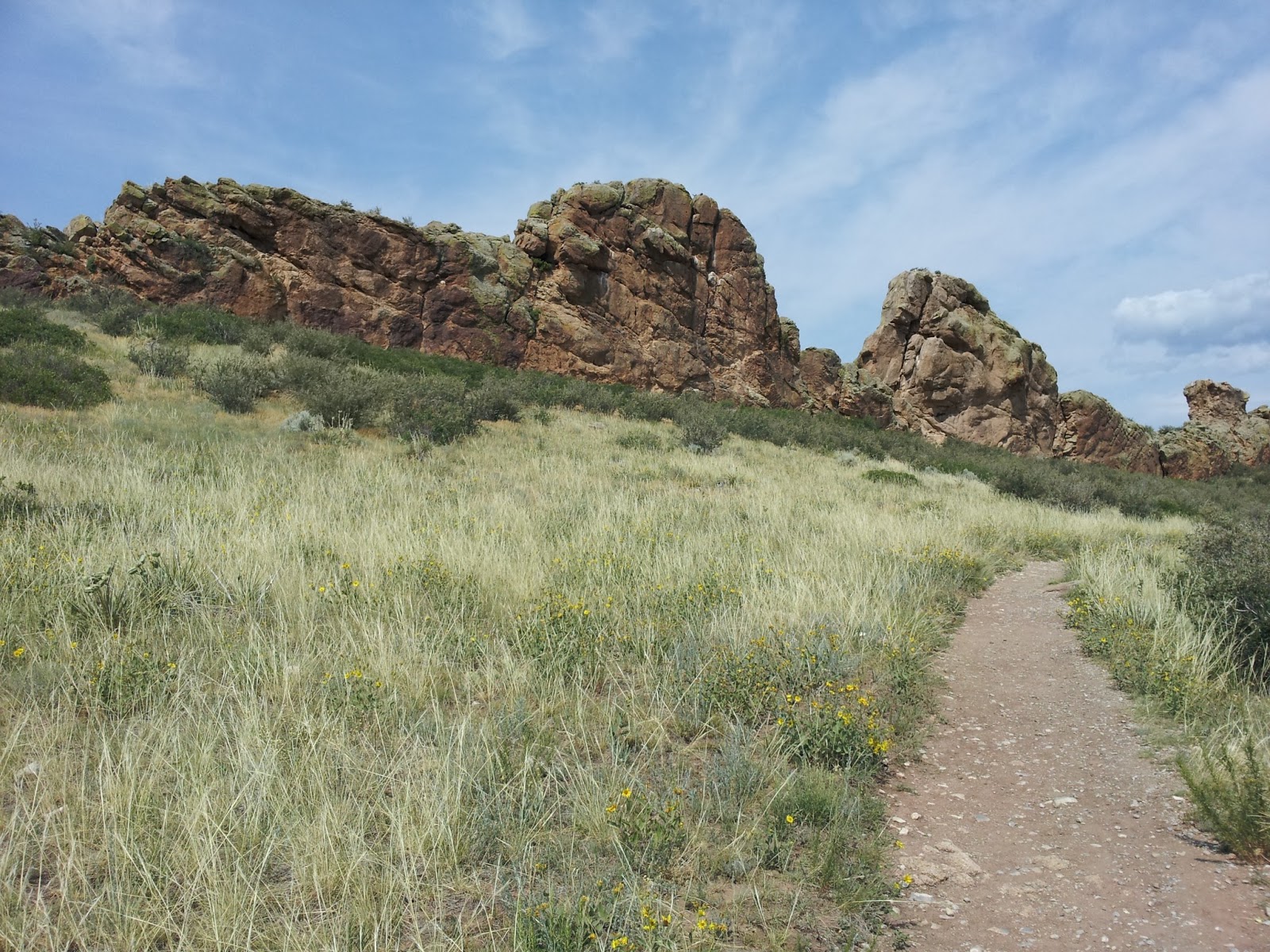
| Chair Rocks |
After reaching Spring Creek Road, we turned north, in the opposite direction of the trail just long enough to refill on water from the firehouse. This is listed as being for emergencies only, but we noticed everyone was using it to re-hydrate. Then we were back on the trail.

We continued on to Tramway Creek, about half way through Segment Three. The creek was a bit underwhelming when we reached it, but we were tired and it was almost suppertime, so we called it home for the night. With just a trickle of water in the "creek", Neal was having trouble getting his nalgene bottle full without getting lots of floaties. We had a good laugh when I offered him my handkerchief to filter through. After seeing me bath with it earlier that day, that didn't appeal to him! Or maybe we were just exhausted enough that anything would have been funny.
 |
| The Colorado Trail symbol reassuring us that we are still on the right trail! |
The first half of Segment Four through the Lost Creek Wilderness was the most physically taxing part of our trek. There are several very steep sections back to back. But there are also portions like the one pictured below that make it worth while! And at least we didn't have to worry about dodging mountain bikers around every switchback.

After topping out shortly before reaching the edge of the Lost Creek Wilderness, there is an absolutely amazing stretch of trail, that is just the right angle of downhill that makes it a real pleasure. We camped for the night just on the other side of Lost Creek where we celebrated Neal's birthday with a couple of Fat Tires I packed just for the occasion.
 |
| The view from our campsite on Tuesday morning |
The following morning was probably the best part of the whole trip. The last half of Segment Four is spent slowly ascending through the beautiful Lost Creek valley. The trail goes up along the west side of the Lost Creek Wilderness in the shadow of the trees.

After reaching the saddle, which is so gradual that you can't really tell where the saddle is, we plunged back into the forested Lost Creek Wilderness area. Neal took a quick panorama of me taking a much needed break and enjoying the vistas.

Even hiking with a friend, you spend a lot of time with your own thoughts while on the trail. One of the things I occupied my mind with was thinking about how long distance hiking is a metaphor for life. There are some parts that are just very difficult, like the uphill sections and sore muscles, etc. But these sections also offer you the opportunity to gain strength from those around you and are usually the most interesting things to discuss later. What doesn't kill you, truly makes you stronger. Another similarity is just the idea of putting one foot in front of the other. That is not to say that walking/hiking is the answer to all life's troubles, but when things get tough, when you aren't sure you can go on, just do the next thing that need's doing, and then do the next thing, and you'll eventually get through the tough part. These rough sections make the amazing views and highlights of the trip that much more incredible. Neal and I discussed at one point how if you had driven up to a lookout in an automobile, you would enjoy the view, but that same vista, reached by backpacking there for several days, suddenly becomes a breathtaking view, but moreover, it becomes an unforgettable experience.

We reached the halfway point of Segment Five where we refilled on water, but since it was still mid-afternoon and the area was so plagued by mosquitoes, we decided to continue on, in spite of the gathering clouds. We met a larger than life, long distance hiker by the trail name of Hawkeye. He is a volunteer/fundraiser for the Telluride Adaptive Sports Program. He had lots of interesting stories to tell from his Appalachian Trail, Continental Divide Trail, and the Pacific Crest Trail treks. Please checkout his website, http://www.gohawkeye.com/index.html. We soon found ourselves nearing the high point near Kenosha Pass with lightning striking within a mile. Despite our better judgement, we hustled through the treeless sections in an effort to reach the Kenosha Pass Campground before dark. We reached the campground right around suppertime after hiking 23 miles that day. Yikes! It was actually nice to find running water and toilets there though.

The next morning we met up with Hawkeye again and he took our picture with Georgia Pass in the background. We met another long distance hiker, Kittens, who also had some interesting stories from his Appalachian Trail trek.

 |
| The view from the high point of the trip, Georgia Pass |
We reached the Continental Divide at Georgia Pass just after noon with lightning striking several miles away, so we didn't take much time to celebrate. We snapped a quick picture and kept on humping. We spent that night camped where the trail meets the North Fork of the Swan River. This was a perfectly nice spot, if a little crowded. But upon arriving I suddenly lost my appetite and wasn't feeling 100%. However, after a good night's sleep, I was feeling better and we were back at it the next morning, feeling good knowing that Breckenridge was just a few hours away! It was actually nice that we were well rested for the steep 1,000 feet ascent we faced first thing. We reached Breck at 12:30 PM and took the Summit Stage bus to downtown. We hustled to the Breckenridge Brewery where we requested an outdoor table for obvious reasons and downed a couple of cold ones and a cheeseburger in record time. When the waiter asked what we wanted, Neal said, anything that doesn't start with "Boil two cups of water". We, of course, followed up lunch with a crepe from Crepes A La Cart. We were able to move our reservation at the Fireside Inn hostel where they did our laundry and provided a nice place to cleanup and get some much needed rest on the cheap!
 |
| Post trek priorities, 1. Beer X two, 2. Cheeseburger, 3. Shower, 4. Nap |
If I was to do it over again, I don't think I would go at the pace we set, but we just wanted to prove something to ourselves and being able to brag about shaving a day and a half off the trek puts a big smile on my face every time!


